
Andy Crawford takes you along on his drive on the Kancamagus Highway – a road through the beautiful White Mountains of New Hampshire.

Kancamagus Highway map
The Kancamagus Highway is one of the most scenic I’ve ever taken. The drive is just a tad longer than 56 miles, but it winds through New Hampshire’s White Mountains and includes spectacular scenery that offers plenty of opportunities to get out and explore the landscape. Following are some of the sights I saw on my drive.

Hazy White Mountains
The Kancamagus Highway winds through New Hampshire’s White Mountains. It is one of the most scenic drives I’ve ever undertaken, and should be on everyone’s adventure list. (Photos: Andy Crawford Photography)

Lincoln Woods Trailhead bridge
Hiking trails are all along the Kanc, as the Kancamagus Highway is known to locals. The Lincoln Woods Trail begins with a suspension bridge that crosses the East Branch of the Pemigewasstt River.

East Branch of the Pemigewasset River
The White Mountain National Forest, through which the Kanc winds, includes some beautiful waterways. This is the East Branch of the Pemigewasset River as seen from the bridge at Lincoln Woods Trailhead.

There are rest stops all along the route, with picnic tables located in some of the most scenic settings you can imagine. Kids can explore the rivers, streams and forests after a family lunch break.

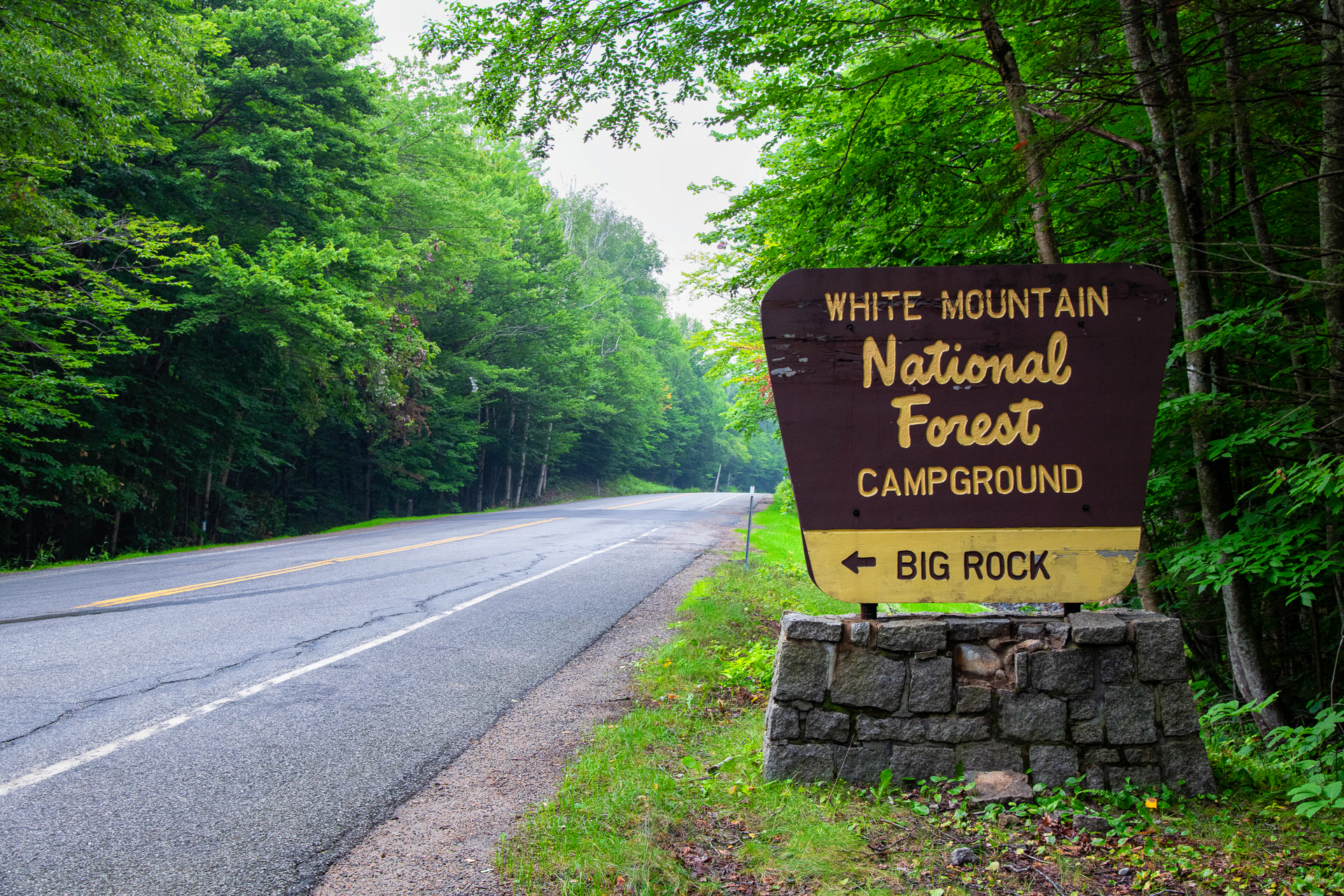
Camping opportunities also are found along the Kanc. Big Rock Campground is just one. The campgrounds offer opportunities for those with campers or tents to enjoy overnight stays in the wilderness of the White Mountains.

Campsites are gorgeous, with plenty of shade and sites that are spaced out to offer isolation from other campers.

Tent campers can set up in the campgrounds on sites that are nice and level, with shade from surrounding trees.

Discovery Trail
There’s even a Discovery Trail near Big Rock Campground. This 1.4-mile loop is designed as “a living classroom in forest ecology,” according to the U.S. Forest Service. Learn about natural and managed ecologies while enjoying the beauty of the forest.

Lily Pond Stones
Lily Pond is a must-see location along the Kanc. There’s a pull-off and a small trail through the brush, and it’s well worth the effort. The pond is dotted with large stones backed by an amazing view of the area.

Overlooks are situated along the Kanc to offer panoramic views of the White Mountains. Unfortunately, the view was obscured during my drive by clouds and smoke from fires out West.

Plaques at the overlooks explain the views and various geological facts pertaining to the White Mountains.

The White Mountains are covered with beautiful fir trees. I want to go back when the view is clearer and I can really see the mountains.

Sabbaday Falls
There also are waterfalls located near the Kancamagus. Sabbaday Falls is reached using a well-maintained trail that begins at a parking lot before snaking along Sabbaday Brook, which forms the waterfall.

There are actually two cascades as part of Sabbaday Falls. Visitors can carefully walk on a rock ledge to enjoy the view of the bottom falls before walking up the trail to see the upper waterfall. The wooden bridge can be seen in the background.

I took the opportunity to create a print of Sabbaday Falls. The landscape is just amazing, with a line of black rock pointing toward the lower cascade of Sabbaday Falls.

Sabbaday Falls pothole
Just off the lower Sabbaday Falls cascade is a pothole in the rocky ledge. I loved how the pothole was backed by the textured rocks and that tree clinging to the ledge. These holes are created when swirling water picks up pebbles and sediment that eventually scours out indentations in which larger rocks settle. Those larger rocks are banged around during flooding, accellerating the process and creating these smooth potholes. Amazing!

Climb to the top of Sabbaday Falls to see how Sabbaday Brook has carved a cleft into the rock.

Church Ponds Trail
The Church Ponds Trail is amazing, winding through the forests and bogs of the White Mountains National Forest. The trail is accessed by parking in the back of Passaconaway Campground and crossing Downes Brook and the Swift River, so bring a dry pair of shoes. Once you reach the bogs, the trail turns to wooden planks that end at Church Ponds.

Church Pond is another of the beautiful ponds located off the scenic highway. But stay out of the water: The campground host told me leeches are swimming around in those waters.

Into Rocky Gorge
The Swift River eventually enters Rocky Gorge, a very popular scenic stop because visitors can walk out on the rocks. It’s important to note that swimming in and around the gorge is strictly prohibited.

This is another view of the top of Rocky Gorge.

A bridge spans Rocky Gorge, allowing a view of the amazing chasm through which the Swift River tumbles.

A trail along the Swift River allows water access below the gorge, which can be seen in the background, below the bridge spanning the river.

The Swift River is the largest of the waterways snaking along the Kanc, and there are numerous opportunities to pull off and sit on the rocks and enjoy the scenery.

Lower Falls is located near the eastern terminus of the Kanc, and it’s an extremely popular swimming area. The river was choked with families enjoying time outside when I stopped.

The Albany Covered Bridge is one located just outside Conway, N.H., and is a wonderful example of the vintage bridges dotting the New Hampshire countryside. The bridge was built across the Swift River in 1858, and is still in use today.


