

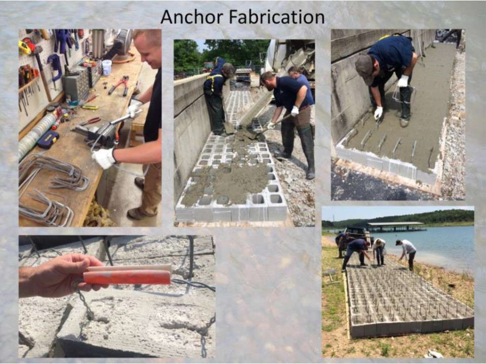
⢠Plywood is placed on the ground, then flat edged cinder blocks are placed side by side.
⢠Blocks are filled with concrete (pea gravel mix works the best when you push handles in later).
⢠We have averaged 115 blocks per yard of concrete.
⢠Each anchor weighs approximately 80 pounds.
⢠Brush the concrete off the top of the blocks with a broom, then push the handles in before the concrete sets up.
⢠PVC handle for carrying blocks (more comfortable on your hands).
⢠Staff pouring anchors on the shoreline for ease of access.


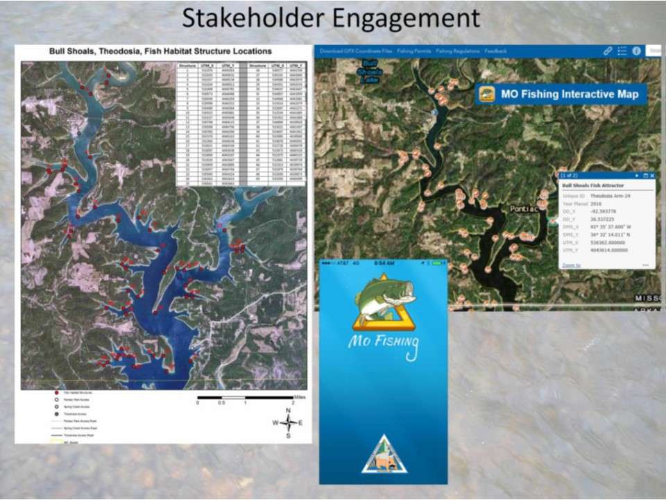
Thank you to all of the cooperators for allowing access to launch the barge and park the barge on the lake near the working areas.