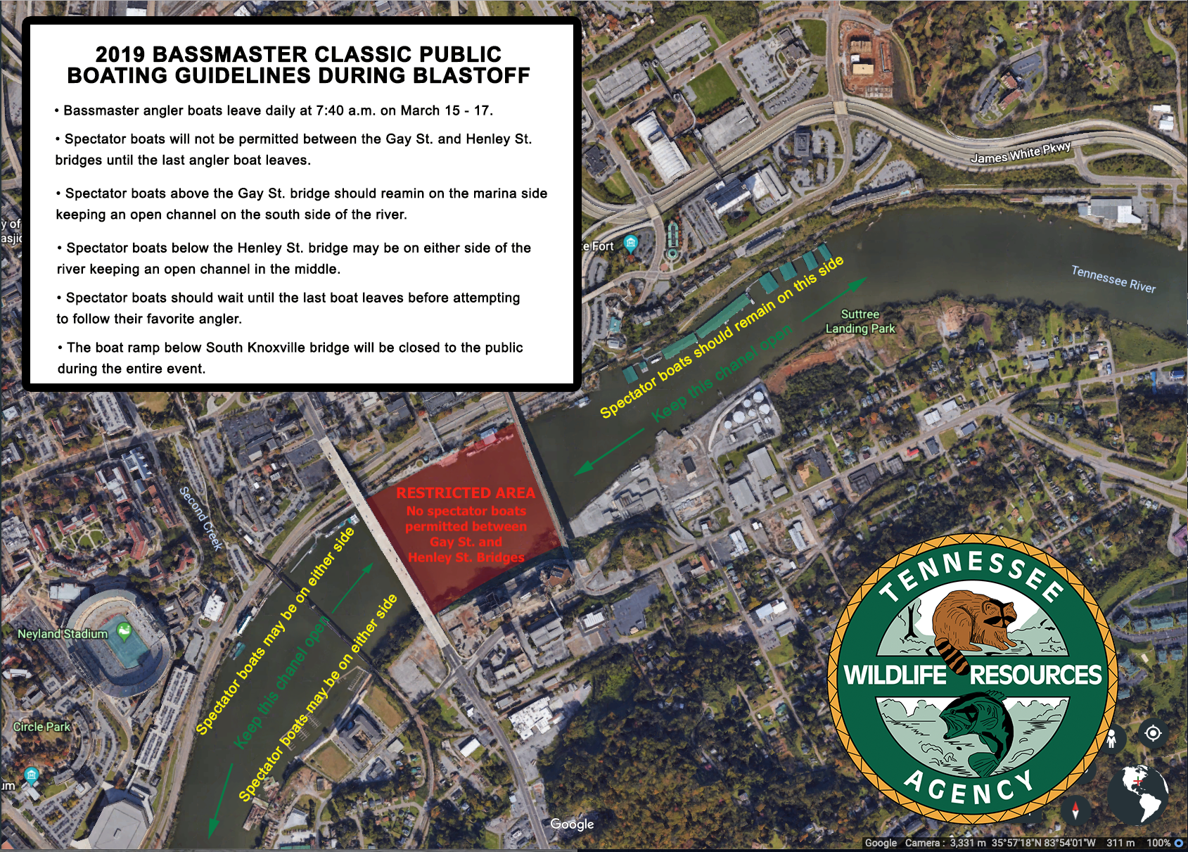
Planning on watching the anglers on the water this week? Here’s some information from the Tennessee Wildlife Resources Agency.
Here are a list of unsafe areas for boating within the Classic boundaries.
Ft. Loudoun
1. Looney Island- TN River Mile 643- GPS 35.931682N 83.953812W- shallow water, follow the channel markers.
2. Sandbar located at the mouth of Little River- TN River Mile 635- GPS 35.881238N 83.990681W- which should be visible depending on water level.
3. The bridge on US Highway 129 (Alcoa Highway) at Little River is very narrow. Use caution- GPS 35.873669N 83.959553W
4. Mud flat where the mouth of Stock Creek comes into the Little River- GPS 35.873634N 83.949847W. The channel markers should be followed in this area.
5. Mud flat just upstream from the I-140 Pellissippi Parkway Bridge- TN River Mile 632- GPS 35.861229N 84.016089W.
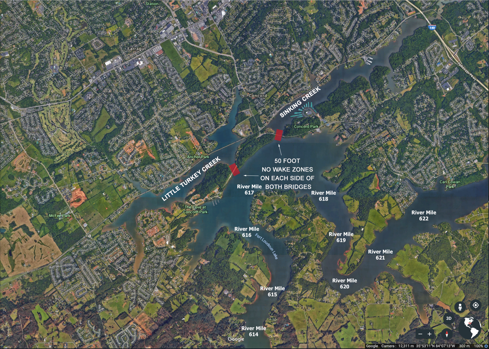
6. Northshore Road Bridges/Sinking Creek and Turkey Creek are extremely narrow- TN River Mile 617- GPS 35.860835N 84.136806W respectively. Per TWRA obtained marine event permit “No Wake” buoys will be placed at both bridges. Extra care should be used in these areas.
7. Rock piles in the Prater Flats area (Gallagher/Ish Creeks) marked with buoys- TN River Mile 612- GPS 35.797074N 84.125558W
Tellico Reservoir
1. Tellico Canal is very narrow, use extra caution- TN River Mile 603- GPS 35.780138N 84.242750W
2. Shoals at Little TN River Mile 1 (Marked by buoy) GPS 35.77123N 84.25877W
3. Rock Pile at mouth of Poplar Creek at Little TN River Mile 5- GPS 35.74469N 84.26105W
4. Poplar Creek Bridge (No Wake) on the Tellico Parkway- Little TN River Mile 4.5- GPS 35.740464N 84.262214W
5. Clear Creek Bridge (No Wake) on the Tellico Parkway- Little TN River Mile 11- GPS 35.674292N 84.271549W
6. Bakers Creek Bridge on Morganton Rd- GPS 35.639680N 84.215972W
7. Little TN River Mile 31- Channel narrows with stumps and rocks on either side.