Global cartography leader C-Map announce today its new series of map products for American boaters is now available for purchase. These new mapping products — C-Map Insight Pro and C-Map Lake Insight HD — combine the trusted chart detail, unique content and popular graphical presentation of C-Map cartography with exclusive chart data from GoFree Lake Insight charts. Boaters and anglers using these charts will also benefit from millions of acres of customized data from the Insight Genesis Social Map, providing the most up-to-date views of underwater contours and lake bed features gathered and shared by actual boaters on the water.
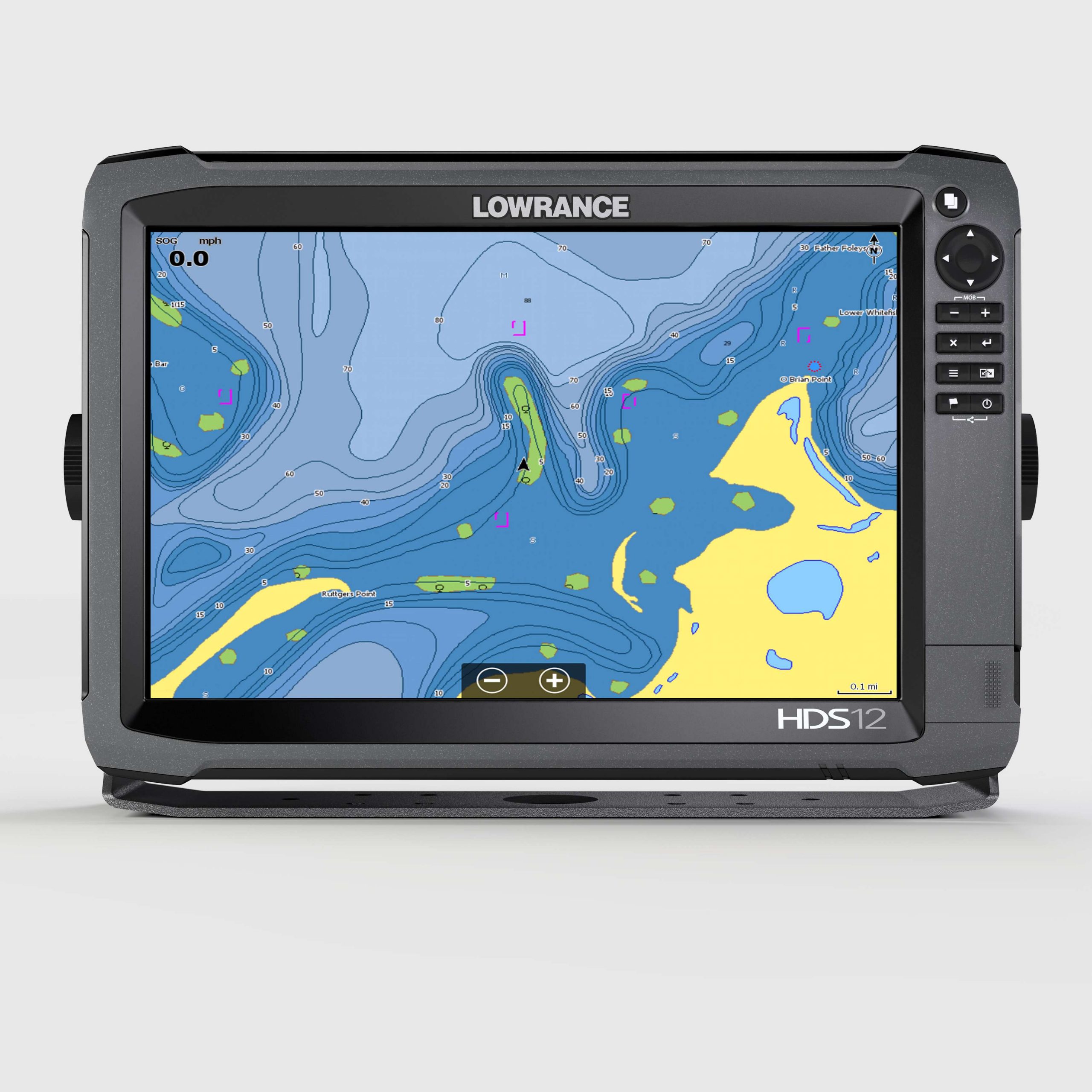
New C-Map Insight Pro gives both coastal and freshwater anglers powerful features designed to enhance their time on the water. These include high-definition 1- to 3-foot depth contours for thousands of lakes and bodies of water, many enhanced with shaded depth contours that make it easy to pinpoint productive areas. Additional angler-specific features include a custom color palette for user-defined depth ranges, state fish and wildlife regulations/fishing records and a wealth of Fishing Hot Spots POIs and lake-specific fishing tips and techniques. Exclusive C-Map High Resolution Bathy (HRB) chart detail is a powerful ally for coastal anglers. These charts also provide boaters with many of the advanced navigation features popularized by C-Map, including an extensive Harbor Charts and Ports Info database, Active Captain crowd-sourced POIs. New C-Map Insight Pro charts deliver all this data and content on a single SD card covering the contiguous United States.
New C-Map Lake Insight HD offers all the Lake related features and content of C-Map Insight Pro, along with additional popular C-Map features including Satellite Image Overlay and Aerial Imagery for enhanced situational awareness and a “bird’s eye” Perspective View chart presentation.
These new charts are offered as a charting option and embedded cartography for Lowrance, Simrad and B&G displays and, as a result of the further development of the Insight offering to a broader audience of boaters and fishermen, Raymarine and Furuno customers will be able to access Insight products when made available in upcoming C-Map 4D releases.
“Our goal has always been to offer the best chart value to our customers,” said Egil Aarstad, CEO, C-Map. “We are leveraging the equity of Navico Insight data and by combining it with our proven chart detail, popular navigation features and graphic presentation, we are changing the game for coastal and freshwater anglers across America. We are very excited to now offer these products on Navico platforms and look forward to making them available to a broader OEM market this year.”
For more information on C-Map Light Marine and Commercial products, visit www.c-map.com.
About C-Map:
C-Map offers the world’s largest marine navigation digital chart database helping its customers explore the digital options and address the complexity of marine operations by providing integrated, intelligent information. C-Map covers the world with accurate, up-to-date electronic charts, Value Added Data & Services that let you sail safely to distant horizons, fill the boat with fish, or cruise with confidence. C-Map cartography is compatible with the latest navigation systems offered by the world’s top manufacturers.